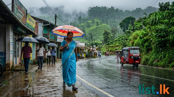
Sri Lanka is currently experiencing the full force of the Southwest Monsoon, a weather pattern that began with intense rainfall on May 6th and officially established across the island by May 27th and May 28th. The initial shift in weather was driven by the Intertropical Convergence Zone (ITCZ) and a low-level atmospheric disturbance, which developed into a low-pressure zone by May 11th. This system gradually weakened and moved away by May 16th, though its residual effects persisted. The Department of Meteorology officially announced the gradual establishment of the Southwest Monsoon on May 19th, a process that was expected to fully establish around May 26th or 27th.
Rainfall Intensification and Forecasts:
Initial reports on May 22nd indicated very heavy rainfall, with 336.5mm recorded in Kegalle, Pambegama, 244mm in Kirindiwela, 238mm in Veyangoda, and 230mm in Avissawella within a 24-hour period. A Red warning for very heavy rainfall was initially issued on May 13th for the Western and Sabaragamuwa provinces, and the Puttalam, Galle, and Matara districts.
Forecasts from late May into early June consistently predicted intermittent rain or thundershowers for the Western, Sabaragamuwa, and North Western provinces, as well as the Galle, Matara, Kandy, and Nuwara Eliya districts. Specific intensity forecasts evolved:
* May 28th: Moderate to heavy showers of up to 75mm were expected in some areas of Galle, Matara, Kalutara, and Ratnapura districts. Rain or thundershowers were also anticipated after 1:00 PM in parts of the Uva province, and the Ampara and Batticaloa districts.
* May 31st: Slightly heavy showers exceeding 50mm were forecast for some areas of the Western and Sabaragamuwa provinces, and the Galle and Matara districts.
* June 2nd: Rainfall was expected to increase, with showers potentially exceeding 75mm in some locations within the Western, Sabaragamuwa, and North Western provinces, as well as the Galle, Matara, Kandy, and Nuwara Eliya districts. This increase was specifically noted for the Central, Sabaragamuwa, and Western provinces, and the Galle and Matara districts, starting from the evening of June 2nd.
* June 3rd and 4th: Rainfall intensity was projected to further increase, with showers potentially exceeding 100mm in some areas of the Western, Sabaragamuwa, and North Western provinces, as well as the Galle, Matara, Kandy, and Nuwara Eliya districts, continuing for several days.
* June 11th: Showers or thundershowers were forecast for Western, Sabaragamuwa, and North-western provinces, and in Galle, Matara, Kandy, and Nuwara-Eliya districts, with falls above 50 mm likely at some places.
* June 12th: Intermittent rain or thundershowers are expected in the Western, Sabaragamuwa, and North Western provinces, and the Galle, Matara, Kandy, and Nuwara Eliya districts, with some places experiencing fairly heavy rain exceeding 75 mm. Several rounds of rain may occur in Hambantota and Anuradhapura districts, and rain or thundershowers are expected in a few places in Uva province, and Ampara and Batticaloa districts after 1:00 PM.
Cloudiness is expected to prevail over many areas, particularly in the Western, Sabaragamuwa, Central, Southern, Uva, North Central provinces, and the Ampara district. Early morning fog may also occur in some locations within the Central, Sabaragamuwa, and Uva provinces.
Wind Conditions:
Moderate to strong winds are anticipated at times. Gusty winds of about 30-40 km/h are forecast for the western slopes of the Central hills, Northern, North-Central, North-Western, and Southern provinces, and the Hambantota and Trincomalee districts. From June 2nd onwards, strong winds of 40-50 km/h were expected intermittently across the island, specifically over the Western slopes of the central hills, Northern and North-central provinces, and in Hambantota and Trincomalee districts, with fairly strong winds of 30-40 km/h over other areas. The department also warns of temporary strong winds and lightning accompanying thundershowers.
Impacts and Warnings:
The continuous rainfall has significantly impacted daily life, prompting authorities to issue comprehensive warnings for heavy rain, strong winds, and lightning.
* Flooding has been reported in the Monaragala area. The Kalu River, Kelani River, Attanagalu Oya, and Maha Oya reached minor flood levels in several areas, with the Kelani Ganga and Kalu Ganga at flood risk. The Attanagalu Oya reached a minor flood level at Dunumale, leading to the submergence of several roads in the Gampaha district, including the Gampaha-Ja Ela, Gampaha-Ganemulla, and Biyagama-Malwana routes. While major river water levels had risen, they are now returning to normal.
* Significantly, 19 major and 18 medium-sized reservoirs are currently overflowing.
* Landslide warnings are currently in effect for 6 districts, with pre-warnings previously issued for 13 districts.
* The adverse weather has affected a total of 31,072 individuals from 7,983 families across 14 districts, with 1,724 people housed in 18 safe locations. 192 partial house damages have been reported.
* Rough seas are also anticipated in deep and shallow sea areas around the island and the Bay of Bengal.
Emergency services are operating 24/7 to assist the public. The public is strongly advised to take necessary precautions, exercise caution against temporary strong winds and lightning during thunderstorms, and stay updated on the latest weather forecasts from the Department of Meteorology.