A low-pressure area situated to the northeast of Sri Lanka (near coordinates 10.1N, 82.5E) continues to persist, influencing weather patterns across the island. Initially identified as a pre-monsoon condition and a low-level atmospheric disturbance on May 6th, it evolved into a low-pressure area by May 11th, prompting an amber advisory from the Department of Meteorology.
While earlier forecasts predicted the system would move away and gradually weaken within 36 to 48 hours, the latest updates confirm its continued persistence. The Department of Meteorology is closely monitoring its behaviour, development, and trajectory.
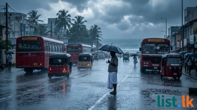
Widespread showers and thundershowers are anticipated across most parts of Sri Lanka, particularly after 1:00 PM daily. However, intermittent showers or thundershowers are expected at times in the Western, Sabaragamuwa, Central, North-western, and Northern provinces, as well as in the Anuradhapura, Trincomalee, Galle, and Matara districts. Showers or thundershowers may also occur in the Uva and Eastern provinces after 1:00 PM.
Heavy rainfall is a significant concern. While initial forecasts indicated rainfall exceeding 100 mm, recent updates have highlighted even more intense precipitation:
* Very heavy rainfall of about 150 mm was possible in some areas of the Western, Sabaragamuwa, and North-western provinces on May 15th.
* Heavy falls exceeding 100 mm were likely in Galle and Matara districts on May 15th.
* Heavy showers of about 100 mm were possible in some areas of the Western and Sabaragamuwa provinces on the night of May 15th.
* Currently, moderate heavy showers exceeding 75 mm are possible in some locations across the affected provinces and districts.
The highest rainfall recorded in the past 24 hours was over 250 mm in the Puttalam district (as of May 14th). This intense rainfall has led to significant impacts:
* One death was reported from Batticaloa due to adverse weather conditions (as of May 14th).
* 203 people were affected as of May 13th.
* In Puttalam, 474 families (1264 people) have been moved to safe centers, with reports of submerged roads and rough seas.
* A minor flood situation is possible in low-lying areas around the Kuda Ganga, Magura Ganga, and Attanagalu Oya within the next few hours.
In response to the escalating situation, the National Building Research Organisation (NBRO) issued a landslide early warning until May 14th, 9:00 AM, which was later updated to Level 2 landslide warnings for 11 districts across the island.
In addition to the rainfall, strong winds and rough sea conditions are expected in the sea areas surrounding Sri Lanka and in the Bay of Bengal. An increase in wind speeds in coastal areas is also anticipated. The Department of Meteorology advises the public to take precautions against temporary strong winds and lightning associated with thundershowers. Advisories have been issued for the fishing and naval communities to monitor weather updates due to increased wind speed and rainfall in the sea areas. Misty conditions are also possible in parts of the Central, Sabaragamuwa, and Uva regions, as well as in the Kurunegala district, with generally cloudy skies expected over most of the island.